
The clouds of Hiroshima
A look at what few photographs we have of the mushroom and smoke clouds from the first atomic bombing

The mushroom cloud is an iconic symbol of the nuclear age, and photographs of the clouds over Hiroshima and Nagasaki are frequently used as a short-hand for gesturing at the terrible power unleashed at the end of World War II. The most familiar of these photographs are two taken from planes involved in the missions themselves. For Hiroshima, the American documentary record is relatively sparse, as the focus was primarily on performing the mission — not documenting it.
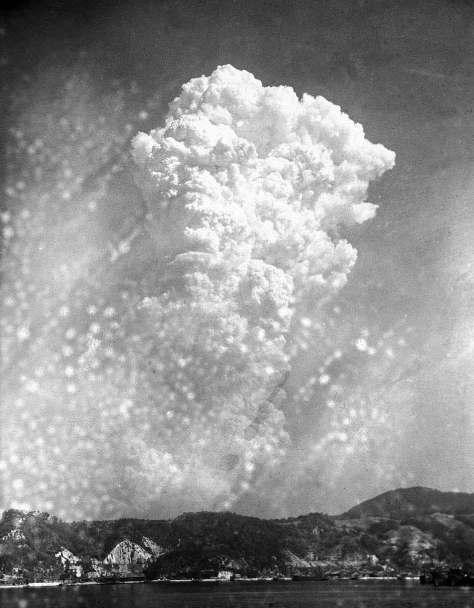
The most familiar of these photos was taken by S/Sgt. George Robert (“Bob”) Caron, the tail gunner on the Enola Gay, the B-29 which dropped the Little Boy atomic bomb over Hiroshima:
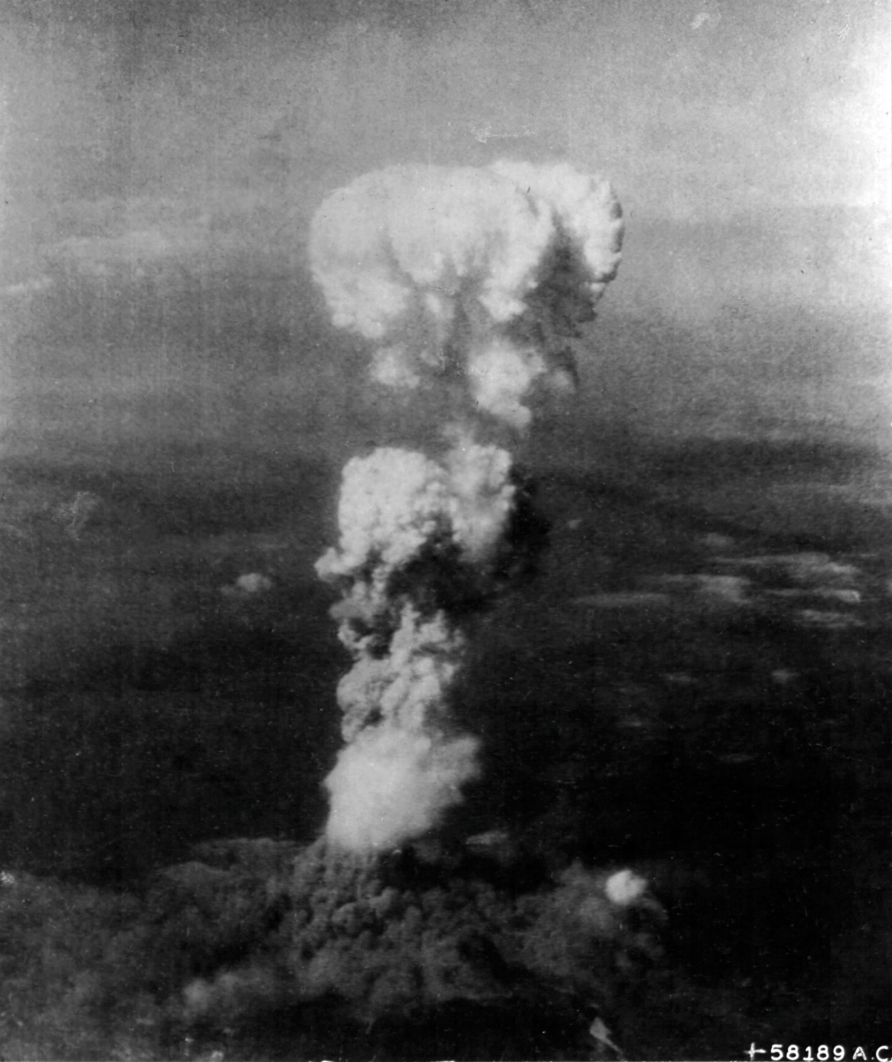
This photograph is surely cropped in the darkroom from a larger negative; it has the gauzy appearance of too little resolution being blown up to too large a size. It is, from a technical perspective, not that great a photograph — the lighting is poor, the focus is poor. This is not an artistic critique, as it was essentially an amateur snapshot taken by a soldier in a combat zone. It does highlight the separation between the “head” of the mushroom cloud and the “stem” of it, a consequence of the weapon’s height of burst.
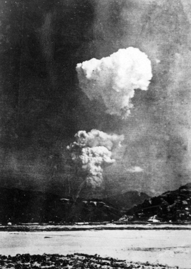
There is another photograph by Caron that gives us a sense of how much the previous one was cropped. This one is far less commonly used, but I prefer it greatly:
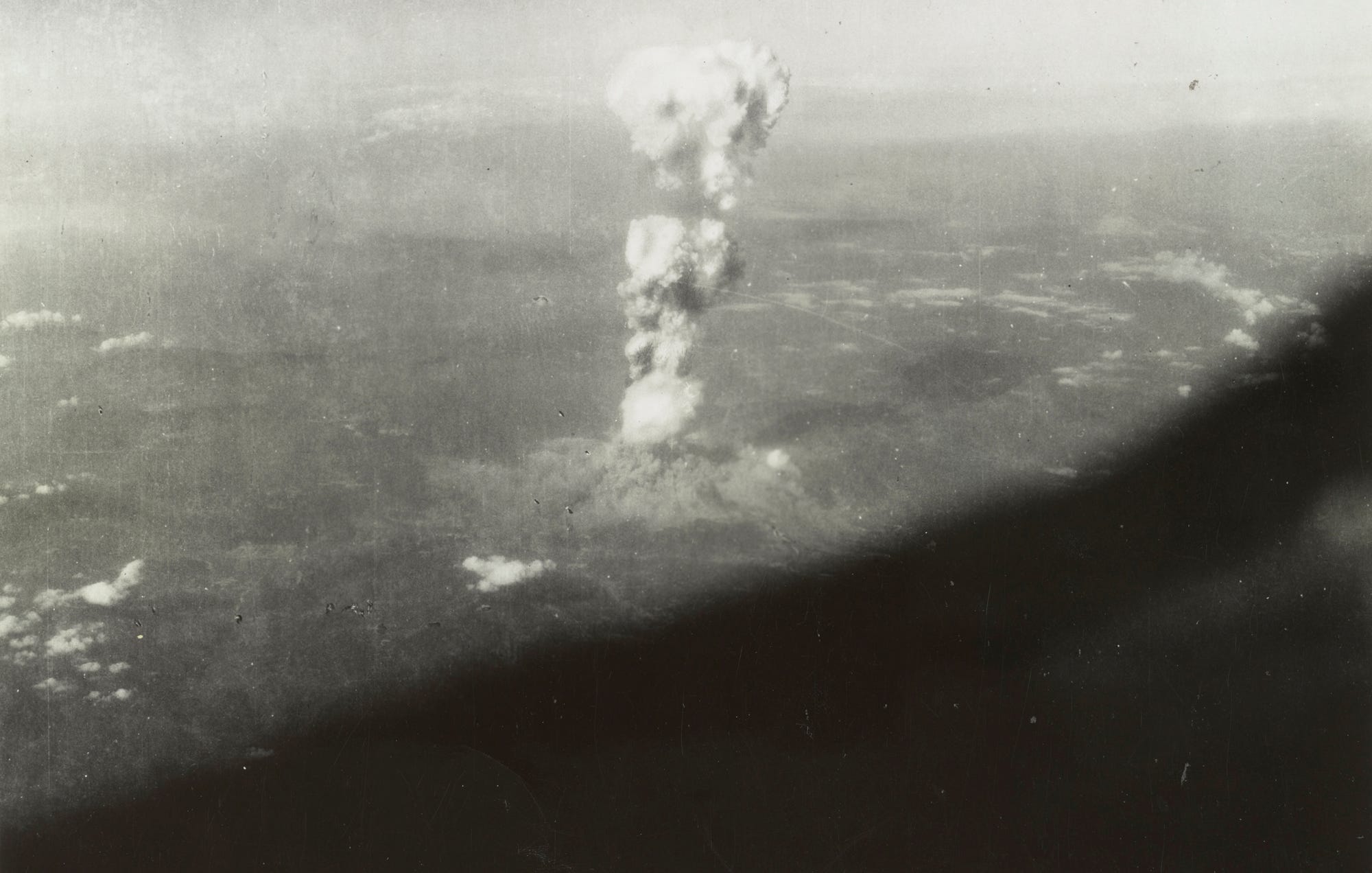
I feel that whatever the cropped version gains in terms of getting a better view of the cloud, it loses its sense of scale and immediacy. The wider shot allows one to better imagine what it would look like to be seeing this in real life, from the air, and gives a better sense of scale — especially since most of us today are very familiar with the view from outside of an airplane.
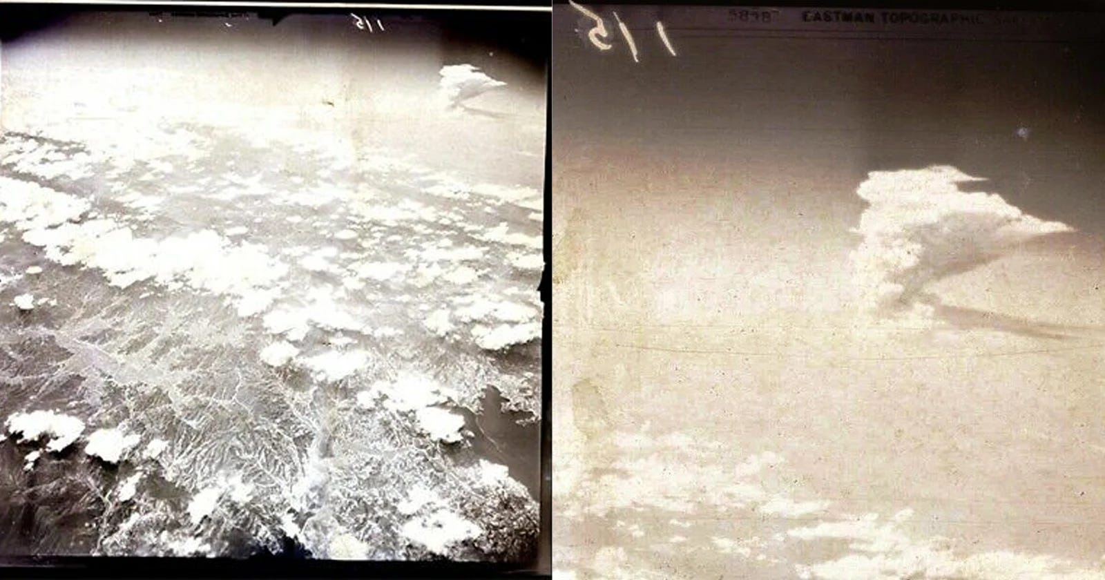
Is the first photograph simply the cropped version of the second? I think not. If you superimpose them, as I have done below, you can see that there are some key differences:
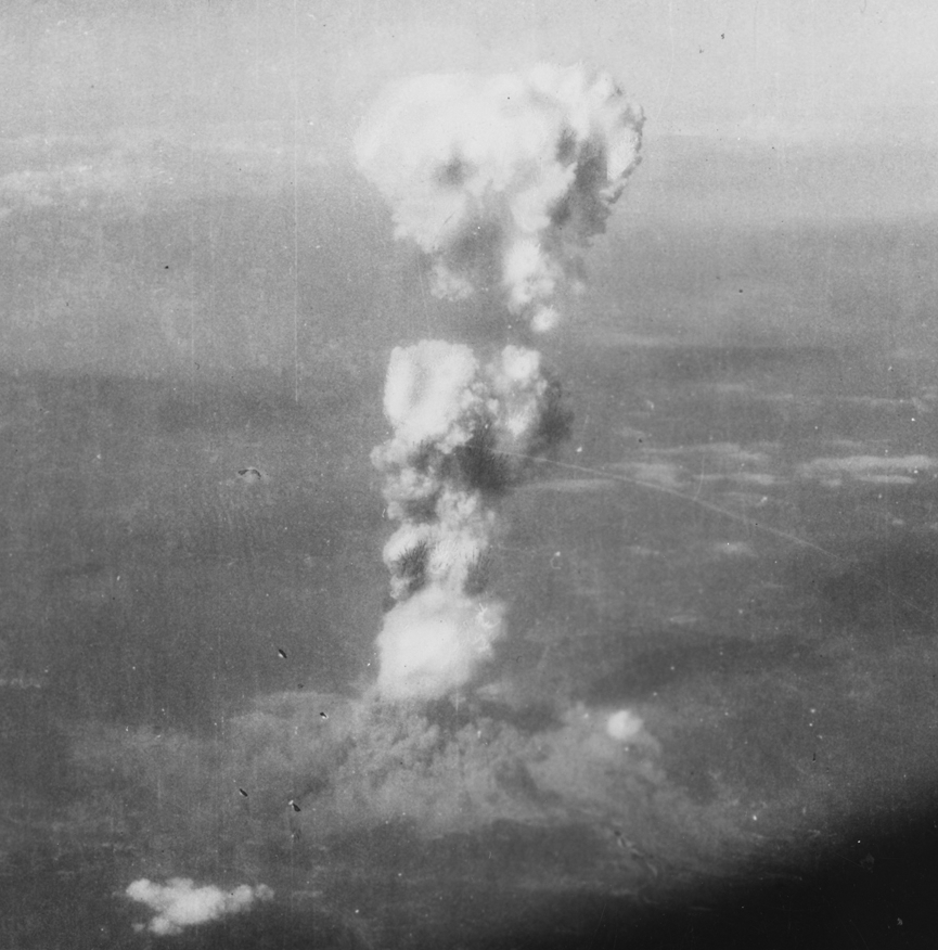
Even barring my own alignment issues, the cropped photograph (581589 A.C.) seems to have been taken a bit earlier than the second one, as the “head” and “stem” separation is a bit different, the “head” is reaching a bit more upward in the second photograph, and, importantly, the entire cloud is rotated slightly along the axis, presumably because of the movement of the plane. It is difficult to tell but one suspect that the cropped photograph was used (and cropped) because it had slightly more definition in the final cloud than the second one.
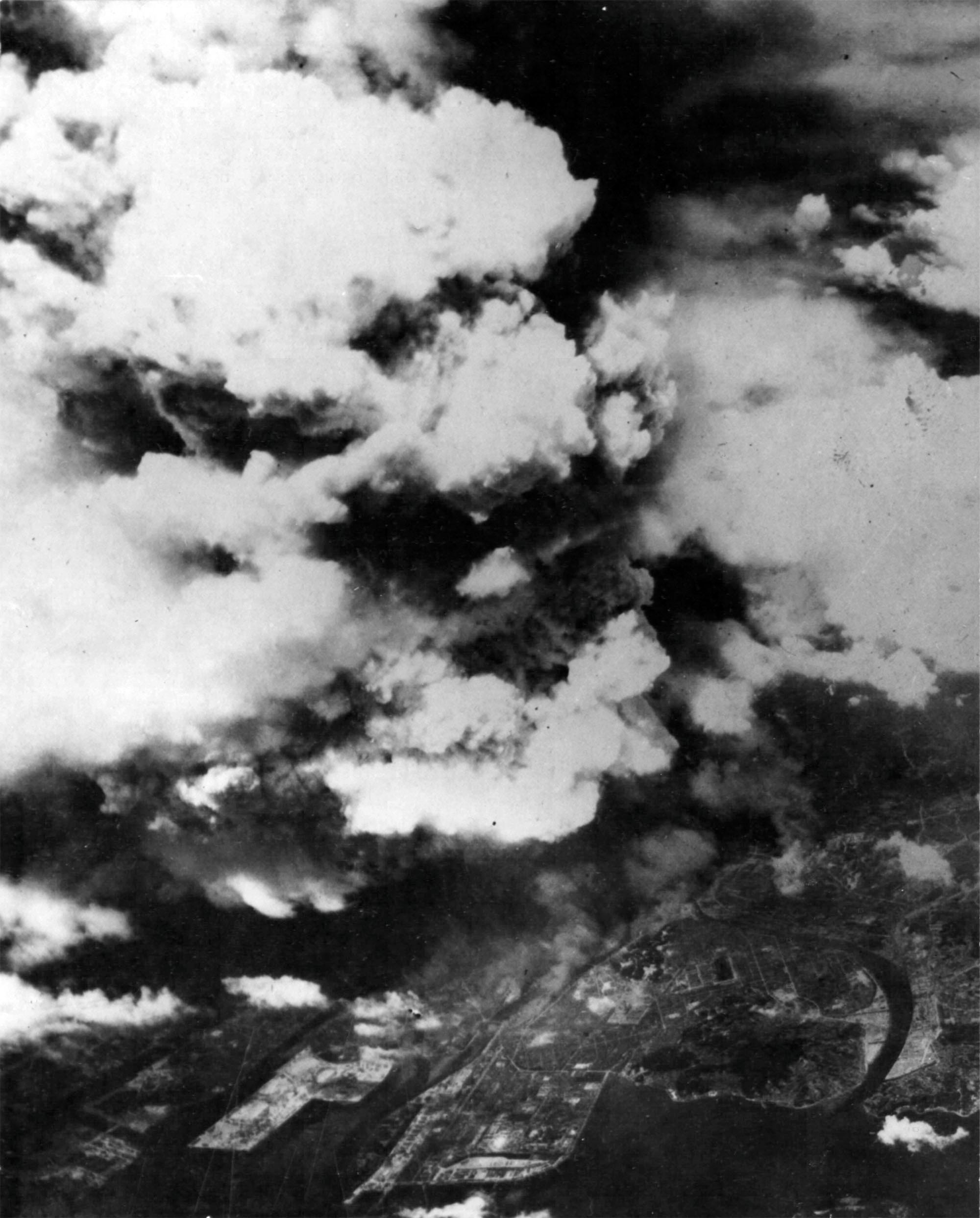
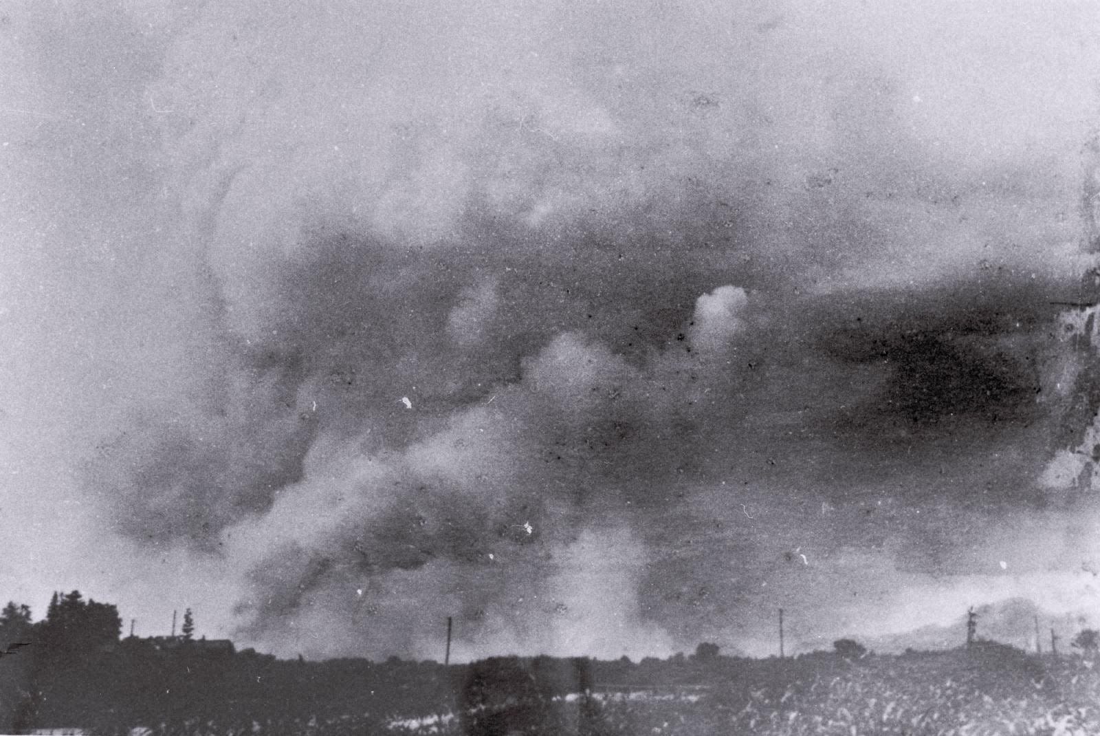
There is another photo of Hiroshima after the bombing that is often used to illustrate its cloud:
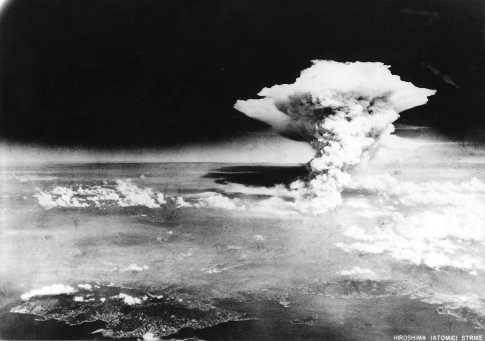
It is an impressive sight. Taken at a much greater distance, the cloud here is much higher than the previous ones, and casting quite a shadow. But this does not actually show the mushroom cloud from the atomic bomb at all; this was taken several hours later, well after the initial mushroom cloud had stabilized and been blown away in the wind. Rather, this is a pyrocumulus smoke cloud caused by the firestorm in the city. For the sake of simplicity I will call this the “smoke cloud,” to differentiate it from the “mushroom cloud” created by the immediate detonation of the atomic bomb.
The photo above was taken by a reconnaissance plane several hours after the attack. From the perspective of the Army Air Forces, these were not successful attempts, because the smoke from the fires obscured their attempts to photograph the ground for at least another day. Here is another photograph, from much closer, of a later reconnaissance attempt, where the cloud is not really meant to be the subject, but is obscuring the subject — the city:
It would not be until August 8, 1945, that they would succeed in getting a completely “clean” (smoke-free) photograph of Hiroshima.
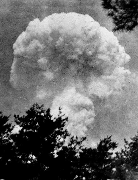
There is one more photograph that I have seen listed as a view from above, supposedly from the collection of a member of the 9th Photographic Technical Squadron, and only “rediscovered” fairly recently:
The above photograph also shows a pyrocumulus smoke cloud. Is it of the Hiroshima smoke cloud, or some other attack? I can’t really tell visually; the landscape looks like a lot of Japan does from the air at that time, and I’m not versed enough in aerial reconnaissance to really pass judgment. It seems plausible, anyway, but given as the owners of the photograph were listing it as the centerpiece of an eBay auction with a ridiculous price tag, I am wary of taking self-interested claims at face value without some confirmation. It does resemble the other smoke cloud photograph geometry, but perhaps many firestorm clouds look somewhat similar. (I have no idea what price was ultimately achieved on the auction, if any.)
Lastly, there is also 16 mm film footage of the Hiroshima cloud, shot from the instrument aircraft, The Great Artiste, by the physicist Harold Agnew. A copy has been digitized by the Hoover Institution Library and Archives, which houses the original:
The technical quality is, again, understandably poor, and the movement of the plane dominates it. The two sequences show different times of the clouds evolution. Both look to be somewhat after Caron’s photographs, as the cloud head in the first one is quite broader and looks more stabilized. In the second one, it appears that the cloud head is starting to break apart in the winds. The separation between the head and the stem is quite visible in the first one, as is the fact that there is some significant horizontal displacement between the two; this is present in Caron’s photographs but less obvious.
These are, to my knowledge, the main photographs of the cloud itself from “above”: the view of the bomber, or the reconnaissance plane. It is a view of destruction from several miles up, quite different than the view from the ground. There are a few photographs from the latter perspective, which I will write about at a later time. For now, I just want to highlight a few other photographs of the cloud and smoke itself: these ones taken by the Japanese. The Hiroshima Peace Museum said in 2013 that it knew of 21 confirmed photographs of the mushroom cloud from the ground. I have only seen half a dozen or so, shown below.
The first set are a sequence of three photographs taken by the photographer Mitsuo Matsushige, who was at home some 7 km / 4.3 miles north of ground zero. He appears to have rushed outside and photographed the cloud within a minute or two of the detonation:
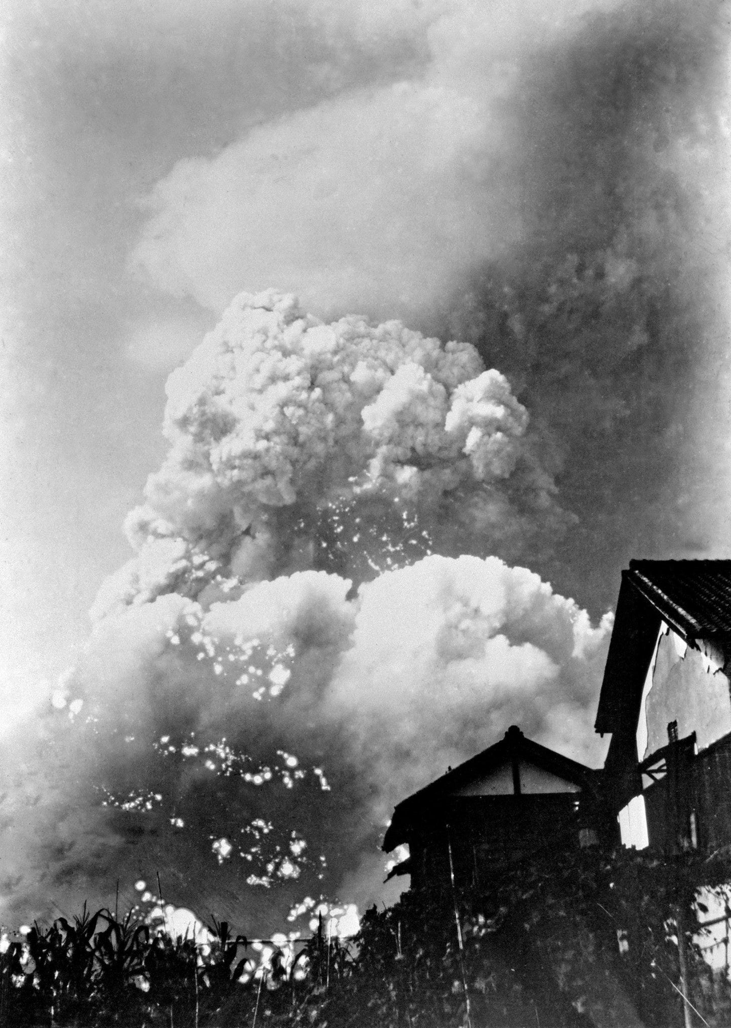
The above photograph is really perhaps the most amazing photograph of the cloud that I have seen. The immensity is obvious. The houses give it an immediacy and some sense of scale. Anyone who has tried to photograph large clouds or buildings knows that it is very difficult to really capture the lived sense of scale, so if this is what the photo looks like, the reality must have been even more awesome. We are, I think, looking up at the mushroom stem, with the separated mushroom head much further above and harder to make out.
At this distance from ground zero, Matsushige was far-enough away that blast, acute radiation, or thermal radiation were not a threat. He may have been in an area that would be exposed to “black rain” — precipitation caused by the aforementioned smoke clouds — which contained some amount of radioactivity. The question about whether the black rain from Hiroshima measurably increased cancer rates is a controversial and tricky one.
Matsushige has another photographs of the cloud from the ground, presumably taken shortly after the first one:
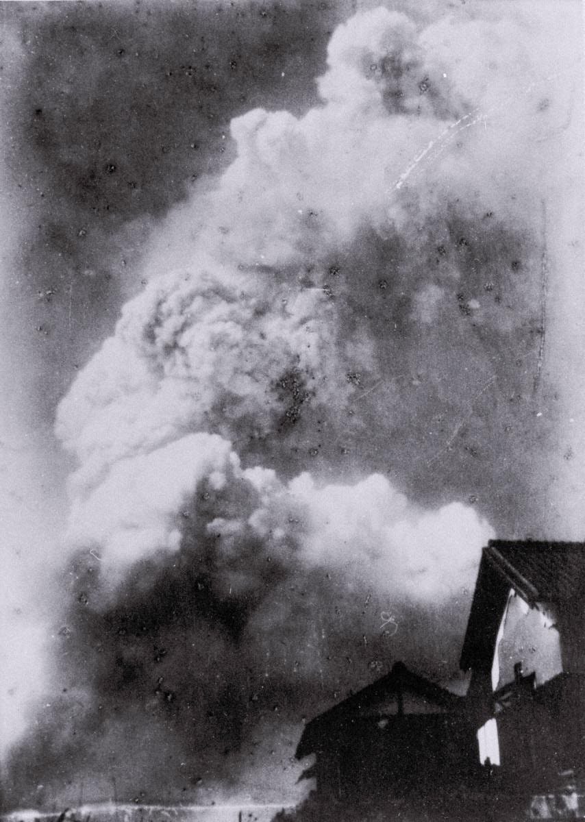
Again, it is a striking photograph, and again, I think this is only the “stem.” The “poor” quality of the negative — my photography teacher in high school would have rejected this for its spots and problems — adds to the reality-effect in this case, given the context.
Mitsushige also took one more photograph, at what looks like a later time, and from a different vantage point:
This photograph was apparently taken around noon, several hours after the attack, and as such is a complement to the aerial photographs of the smoke fire.
There are a few other such photos from the ground, such as this one taken from Kure Naval Arsenal, some 20 km / 13 miles to the southeast of Hiroshima:
This looks either like a quite late mushroom cloud, or an early stage of the smoke cloud. I suspect the latter, just based on its particular size and geometry, but it is hard to tell. Whatever it is, it is not very mushroom-like in its appearance at this point; mushroom clouds do look more like “columns” after they stabilize, so it is not impossible, although I suspect it is the smoke cloud. The Library of Congress lists it as an “unusual photo of the Hiroshima bomb explosion,” which is an odd choice of words. Do not all of the photographs qualify, in some deep way, as “unusual”?
There is also this photograph that is listed on Wikipedia as being “found in Honkawa Elementary School in 2013 of the Hiroshima atom bomb cloud, believed to have been taken about 30 minutes after detonation of about 10km (6 miles) east of the hypocentre”:
That is definitely the Hiroshima mushroom cloud, with a clear separation of the “head’ and “stem.” I do not think this is 30 minutes after the attack; this looks to be only a few minutes after the bombing, on par with the cloud shown in the Agnew film. My guess is that it is still before the mushroom head had reached its stabilized altitude (in which is temperature and density matched the air around it, which stops its ascent), so that would put it at 10 minutes or less after detonation. Apparently the Hiroshima Peace Museum put the time at 20-30 minutes, but even 20 minutes feels a bit late to me. The photographer is unknown.
The last one I will put here is from a very remarkable perspective:
It is a remarkable photograph — a truly literal “view from below.” The above image comes from the Chugoku Shimbum newspaper’s Hiroshima Peace Media Center, who say (per Google Translate) that it was taken by Seizo Yamada, an employee of the Chugoku Shimbun, and that he was some 6.5 km / 4 mi from ground zero at the time, visiting a friend. Yamada described the fireball as “dark red” when he took the picture. The Chugoku Shimbun says that if he had been at work as usual that day, he would have been more definitively under the cloud. The perspective gained by being just a bit further out than Matsushige’s photographs is striking: close-enough to look like it is right on top of the photographer.
The scale of the Hiroshima mushroom cloud, and the smoke cloud, is immense, and hard to fathom. In fact, it is hard to know the exact height: while later equations were developed for generalizing the stabilized heights of mushroom clouds as a function of weapon yield, the “raw data” of these, derived from nuclear testing, shows considerable messiness. But from a human perspective, they are huge — many multiples of our tallest buildings. The next time you are at the base of a building like One World Trade Center in New York City, consider that the Hiroshima cloud was well over 10 times taller than it.
In a future post, I will talk about the similar cloud photography from Nagasaki — which has many interesting differences in terms of appearance and documentation — as well as other kinds of “on the ground” accounts of the atomic bombings.
I did a Google Earth overlay which I think matches the rough position of the Caron photograph. Based on an Enola Gay flight path video (https://www.youtube.com/watch?v=A4-j1FyiWvw) and orienting using the location of the A-bomb dome and what I think is the Ota River in the lower part of the photo.
Full photograph:
https://i.imgur.com/rDzgR7G.jpeg
Semi-Transparent.
https://i.imgur.com/yzzZMTW.jpeg
Regarding the mystery photo of the firestorm cloud, the orientation of the shadow tells us that, IF it is of Hiroshima, it was taken roughly 100km to the ENE. (The firestorm cloud rose to almost 20km.) There is, however, no current coastline to the ENE of Hiroshima that matches the bays visible in the lower right of the photo. There have, of course, been many modifications all up and down the coast in the 80 years since WWII, so this does not necessarily rule out this being a photo of the Hiroshima firestorm cloud.
Nonetheless, the search should be expanded to include the other dozen or so firestorms trigger across Japan by the US firebombing campaign -- the most famous being Tokyo. It would not be surprising if at least one the other pyrocumulus clouds were photographed. This photo seems to have almost inadvertently capture this cloud.
I challenge geography buffs in Japan to identify the location and orientation of the bays and then match it up with one of the firebombed cities.